

Michael13
Well-Known Member
Many visitors to the Portland , Oregon area like to spend a day or two checking out the waterfalls along the Historic Columbia River Highway Scenic Byway. This post is meant to help photographers determine the photographic interests of specific areas along this route to help them plan their visit. I am fortunate enough to live close by and visit here frequently. Hopefully, this info will help you make the most of your visit when you get the chance.
Wikipedia says" The Historic Columbia River Highway is an approximately 75-mile-long (121 km) scenic highway in the U.S. state of Oregon between Troutdale and The Dalles, built through the Columbia River Gorge between 1913 and 1922. As the first planned scenic roadway in the United States, it has been recognized in numerous ways, including being listed on the National Register of Historic Places, being designated as a National Historic Landmark by the U.S. Secretary of the Interior, being designated as a National Historic Civil Engineering Landmark by the American Society of Civil Engineers, and being considered a "destination unto itself"[4] as an All-American Road by the U.S. Secretary of Transportation." I say it's a great place to be a photographer.
So visiting from Portland, make your way to I-84 and head east. Take exit 22 to Corbett, follow it up the hill where it joins Historic Highway 30. Turn left here and the adventure begins. Here's a map from Oregon State Parks ...

First stop is at the Portland Women's Forum State Scenic Viewpoint, with it's iconic view of Crown Point, Vista House and the Columbia River. You've probably seen postcards of this view, and it's a must stop for all travelers. As of this posting (June, 2025) the shrubbery around the viewpoint has grown rapidly and somewhat obscured the views, so you probably won't want to spend too much time here.

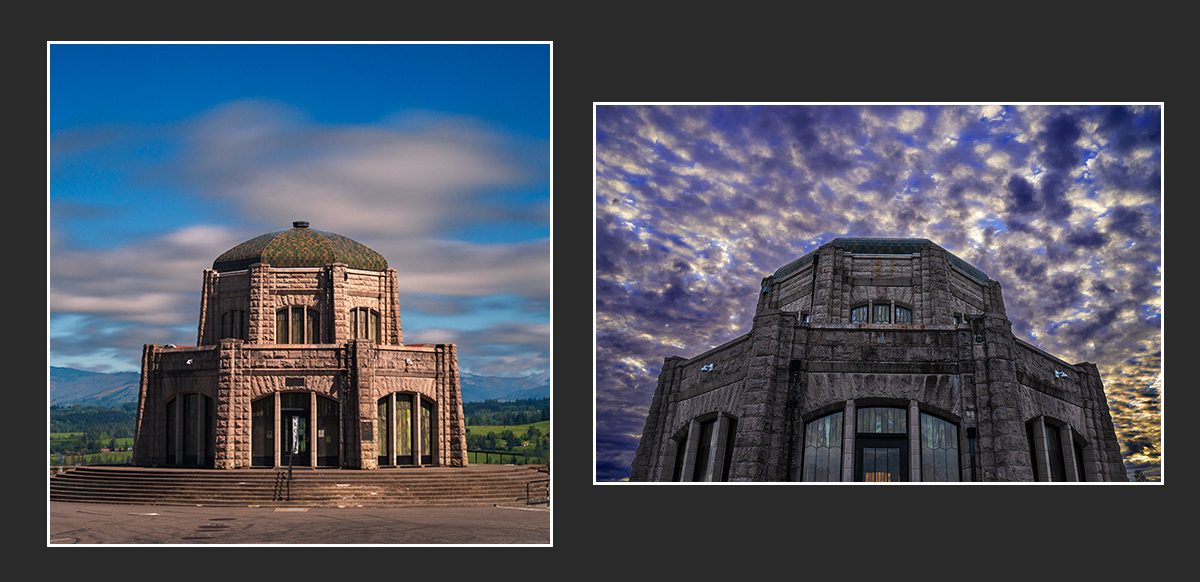
Continuing east on the highway, you arrive at Crown Point just a few minutes later. Here you can make some nice images of the Historic Vista House itself, or the panoramic views in all directions. In years past, this area included a gift shop inside and Park Rangers were on hand to dole out information to visitors, not so much lately. Still it makes a great stop for photos!
A couple of miles further east, you arrive at Latourell Falls. The beautiful falls here are reached via a very short trail through the trees. There are nice views from the trail, and at creek level with the wooden footbridge. This one is a must stop.


Just a half mile further east is Shepperd's Dell, where a very short trail takes you to creek level at the falls. Probably best seen from just below the bridge as you walk down, the view is just OK compared to others on this trip. Not a must-see at all, I'd omit this one if pressed for time.

In another two miles you'll arrive at Bridal Veil Falls, where a 0.8 mile roundtrip hike takes you down a gentle trail to a constructed viewing platform of these lovely falls. It can be a challenge to find the best angles shooting here, but the hike is lovely and a nice experience if not too crowded.

It's another three miles till you arrive at Wahkeena Falls, one of the highlights of this trip. There are great views from the bottom of the creek of the water cascading down the hills, but there's even more to see if you can hike the strenuous trail as far as Fairy Falls, seen in the image below on the right. Like most trails in the gorge, this trail connects to others if you wish to take an extended hike. A must stop for photos.


Just a half mile further is Multnomah Falls, the grandaddy of them all. No doubt you have seen images of this iconic falls all over Instagram, Facebook, and everywhere else. It is the poster child for Oregon's Parks and the highest waterfall in the state. I will say it is a must stop, but as of this post (June 2025) there is extremely limited Hwy 30 parking there , I'll explain more in the notes at the end of this post. It has sadly become too popular for its own good, as it's the only place along this route to buy a latte or soft serve ice cream. Expect a very touristy experience. If you can be there very early, you can make a nice photo of both falls in one image. Works well in Infrared too. I'd skip this one if it's already too crowded when you arrive.

Two miles further east is Oneonta Gorge, which I can't show you here. This place has been closed since the 2017 Eagle Creek fire left the area scorched and it has since seen many landslides and rockfalls making the area too unsafe to visit. The area is blocked off with chain link fencing and posted with signage stating it is off limits. At this time the forest service says it will remain closed through 2026. After that, who knows?
A mile later, we come to Horsetail Falls, another must stop, with the gorgeous falls right at the parking area. This can be a quick stop or you can cross the railroad tracks by the parking area to access a beautiful creek side wetlands with lovely views. A good place for portraits also.

Next follow the signs to Dodson for the Elowah Falls trail, about 2.5 miles down the road. Here is a trail that has been devastated by the 2017 Eagle Creek fire and is in recovery mode. The money shot at the end of the trail is not what it once was, and the trail has some washed out areas in places and is a bit sketchy, especially for seniors, or hikers with children or pets. I'd skip this one till it has recovered more. The last photo below shows the aftermath of the fire...


You will need to get on I-84 east to continue on to Wahclella Falls at exit 40. This place requires a Forest Service Pass, or pay a $5 fee at the trailhead. This trail was closed for 2 years following the 2017 fire and is still recovering from the devastation. A nice 2.5 mile roundtrip trail with a bit of up and down hiking is a good workout with the payoff being the falls at the end. There may be a lot of downed trees around in the falls and the creek, depending on when you're there. Still, I'd say don't miss this one - the roar of the falls shooting through the tiny gap at the end is awesome! Climbing up the scree slope on the right will get you to a view over the obstructions.

There are even more falls off the highway further east, such as these on Herman Creek. But reached via a much longer hike, save this for a long hike day when you can spend all day on one long trail.
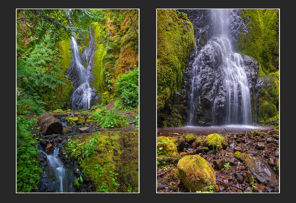
And while the waterfalls are the main attraction here, there are also lush rain forest views everywhere and seasonal wildflowers abound underfoot. There is a lot to keep any photographer busy.


My preference for any of these waterfalls is to arrive there around sunrise. This almost guarantees you will have the place to yourself, at least for a while before the early bird hikers show up. A cloudy day forecast is also good, as all the falls photograph well in diffuse, even light. The direct light on a beautiful sunny day will be too contrasty for pleasing images. A good game plan for a day of photography would be to pick a favorite falls based on web images you can find, then show up there on a weekday for the sunrise money shot. Follow that up with your other choices as time allows for the day. Remember as the day goes on the number of visitors will skyrocket, especially on sunny weekends.
Parking is limited at the viewpoints and trailheads along the route, so earlier is always better! The parking at Multnomah Falls is pretty easy if you access it from I-84 (not the route described here) but from there you cannot access the other falls. Parking on hwy 30 at Multnomah Falls is very difficult these days and the rules have changed a few times in the recent past. A helpful link ...
Multnomah Falls I-84 parking
And lastly, the scenic byway is a narrow, twisty route, that must be driven slowly. It is no place for motorhomes or vehicles towing anything. There are often bicycles traveling in groups and pedestrians on the road where they should not be, so please drive cautiously. I hope you enjoy your trip and bring home many awesome images!
Wikipedia says" The Historic Columbia River Highway is an approximately 75-mile-long (121 km) scenic highway in the U.S. state of Oregon between Troutdale and The Dalles, built through the Columbia River Gorge between 1913 and 1922. As the first planned scenic roadway in the United States, it has been recognized in numerous ways, including being listed on the National Register of Historic Places, being designated as a National Historic Landmark by the U.S. Secretary of the Interior, being designated as a National Historic Civil Engineering Landmark by the American Society of Civil Engineers, and being considered a "destination unto itself"[4] as an All-American Road by the U.S. Secretary of Transportation." I say it's a great place to be a photographer.
So visiting from Portland, make your way to I-84 and head east. Take exit 22 to Corbett, follow it up the hill where it joins Historic Highway 30. Turn left here and the adventure begins. Here's a map from Oregon State Parks ...
First stop is at the Portland Women's Forum State Scenic Viewpoint, with it's iconic view of Crown Point, Vista House and the Columbia River. You've probably seen postcards of this view, and it's a must stop for all travelers. As of this posting (June, 2025) the shrubbery around the viewpoint has grown rapidly and somewhat obscured the views, so you probably won't want to spend too much time here.
Continuing east on the highway, you arrive at Crown Point just a few minutes later. Here you can make some nice images of the Historic Vista House itself, or the panoramic views in all directions. In years past, this area included a gift shop inside and Park Rangers were on hand to dole out information to visitors, not so much lately. Still it makes a great stop for photos!
A couple of miles further east, you arrive at Latourell Falls. The beautiful falls here are reached via a very short trail through the trees. There are nice views from the trail, and at creek level with the wooden footbridge. This one is a must stop.
Just a half mile further east is Shepperd's Dell, where a very short trail takes you to creek level at the falls. Probably best seen from just below the bridge as you walk down, the view is just OK compared to others on this trip. Not a must-see at all, I'd omit this one if pressed for time.
In another two miles you'll arrive at Bridal Veil Falls, where a 0.8 mile roundtrip hike takes you down a gentle trail to a constructed viewing platform of these lovely falls. It can be a challenge to find the best angles shooting here, but the hike is lovely and a nice experience if not too crowded.
It's another three miles till you arrive at Wahkeena Falls, one of the highlights of this trip. There are great views from the bottom of the creek of the water cascading down the hills, but there's even more to see if you can hike the strenuous trail as far as Fairy Falls, seen in the image below on the right. Like most trails in the gorge, this trail connects to others if you wish to take an extended hike. A must stop for photos.
Just a half mile further is Multnomah Falls, the grandaddy of them all. No doubt you have seen images of this iconic falls all over Instagram, Facebook, and everywhere else. It is the poster child for Oregon's Parks and the highest waterfall in the state. I will say it is a must stop, but as of this post (June 2025) there is extremely limited Hwy 30 parking there , I'll explain more in the notes at the end of this post. It has sadly become too popular for its own good, as it's the only place along this route to buy a latte or soft serve ice cream. Expect a very touristy experience. If you can be there very early, you can make a nice photo of both falls in one image. Works well in Infrared too. I'd skip this one if it's already too crowded when you arrive.
Two miles further east is Oneonta Gorge, which I can't show you here. This place has been closed since the 2017 Eagle Creek fire left the area scorched and it has since seen many landslides and rockfalls making the area too unsafe to visit. The area is blocked off with chain link fencing and posted with signage stating it is off limits. At this time the forest service says it will remain closed through 2026. After that, who knows?
A mile later, we come to Horsetail Falls, another must stop, with the gorgeous falls right at the parking area. This can be a quick stop or you can cross the railroad tracks by the parking area to access a beautiful creek side wetlands with lovely views. A good place for portraits also.
Next follow the signs to Dodson for the Elowah Falls trail, about 2.5 miles down the road. Here is a trail that has been devastated by the 2017 Eagle Creek fire and is in recovery mode. The money shot at the end of the trail is not what it once was, and the trail has some washed out areas in places and is a bit sketchy, especially for seniors, or hikers with children or pets. I'd skip this one till it has recovered more. The last photo below shows the aftermath of the fire...
You will need to get on I-84 east to continue on to Wahclella Falls at exit 40. This place requires a Forest Service Pass, or pay a $5 fee at the trailhead. This trail was closed for 2 years following the 2017 fire and is still recovering from the devastation. A nice 2.5 mile roundtrip trail with a bit of up and down hiking is a good workout with the payoff being the falls at the end. There may be a lot of downed trees around in the falls and the creek, depending on when you're there. Still, I'd say don't miss this one - the roar of the falls shooting through the tiny gap at the end is awesome! Climbing up the scree slope on the right will get you to a view over the obstructions.
There are even more falls off the highway further east, such as these on Herman Creek. But reached via a much longer hike, save this for a long hike day when you can spend all day on one long trail.
And while the waterfalls are the main attraction here, there are also lush rain forest views everywhere and seasonal wildflowers abound underfoot. There is a lot to keep any photographer busy.
My preference for any of these waterfalls is to arrive there around sunrise. This almost guarantees you will have the place to yourself, at least for a while before the early bird hikers show up. A cloudy day forecast is also good, as all the falls photograph well in diffuse, even light. The direct light on a beautiful sunny day will be too contrasty for pleasing images. A good game plan for a day of photography would be to pick a favorite falls based on web images you can find, then show up there on a weekday for the sunrise money shot. Follow that up with your other choices as time allows for the day. Remember as the day goes on the number of visitors will skyrocket, especially on sunny weekends.
Parking is limited at the viewpoints and trailheads along the route, so earlier is always better! The parking at Multnomah Falls is pretty easy if you access it from I-84 (not the route described here) but from there you cannot access the other falls. Parking on hwy 30 at Multnomah Falls is very difficult these days and the rules have changed a few times in the recent past. A helpful link ...
Multnomah Falls I-84 parking
And lastly, the scenic byway is a narrow, twisty route, that must be driven slowly. It is no place for motorhomes or vehicles towing anything. There are often bicycles traveling in groups and pedestrians on the road where they should not be, so please drive cautiously. I hope you enjoy your trip and bring home many awesome images!
Last edited:

