Michael13
Moderator
"Malheur Maar is one of the most significant desert lakes on the continent, and is especially usefull for studying past climates. Malheur Maar fits the exact description of a true maar, meaning that no magma surfaced during an eruption. The water in Malheur Maar is about 6 feet deep, and there are about 50 feet of sediments underneath the water which fill up half of the original maar floor. Malheur Maar has contained water for the last 7,000 years. Polen, plant debris, and layers of tephra accumulate rapidly in the lake, which is located at the boundary between the sagebrush and the desert shrub communities." - Eastern Oregon Online
Malheur Maar is part of the Diamond Craters Volcanic Field, an official "Outstanding Natural Area" which is protected by BLM. I was there on a cold September night. The ground started getting mushy close to the water's edge so I had to back up to find a stable place for the tripod.
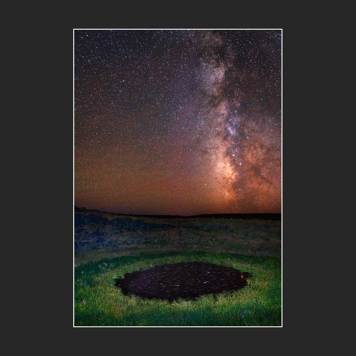
Malheur Maar is part of the Diamond Craters Volcanic Field, an official "Outstanding Natural Area" which is protected by BLM. I was there on a cold September night. The ground started getting mushy close to the water's edge so I had to back up to find a stable place for the tripod.