Views Above the Forest

AlanLichty

Moderator
You may wonder why I have been so enthusiastic about shooting with a drone this last year and these images will offer a pretty good answer. The Gifford Pinchot National Forest in Washington is just north of the Columbia River Gorge and very easy access from where I live in Vancouver. I have driven many of the roads through this area with camera gear at hand and taken a lot of images through the years. The major problem is finding places to shoot vistas that show off the terrain and mountains in the area. This first image shows exactly why such views are scarce with a view of the forests and the Carson - Guler Road. In spite of very heavy logging through the years most of the roads look like this one with 100' (or more) tall trees on both sides of the roads. You can drive many miles with a fabulous view of tree trunks and almost never see the terrain.

In this case I launched my drone and flew straight up to just under 400' and got my first aerial view of the forest in this area after living here for 25 years and driving this road many times. A 24mm image:
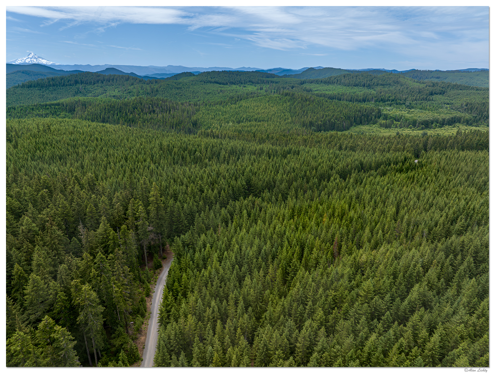
DJI_M3P_24-CarsonGulerRd061623.jpg


It is a bit disappointing to see the patterns of the many clear cuts that have carved up the forests but also a revelation that there was a view of Mt. Hood from this area. I decided to jump over to the 70mm lens and grab a portrait of that volcano:

DJI_M3P_70-HoodGiffordPinchot061623.jpg


I intend to repeat this type of aerial exploration of the Gifford Pinchot NF over the course of the summer to get a better sense of the lay of the land between the Gorge and Mt. Rainier.

C&C always welcome.
 

AlanLichty

Moderator
Nice way to show that terrain. That looks like a pretty dense area of trees. I like how Mt Hood kind of looks over this area.
Thanks Jameel - a very dense area of trees you have probably driven through. This is only about 3 miles farther up the road from Panther Creek Falls and right near where FS65 intersects with FS60 (Carson-Guler Rd). The drainage to the left in the second image is Panther Creek.

I was trying to get to the FS6052 which ends up quite close to the top of Falls Creek Falls but the Carson-Guler Rd is closed off about a mile west of here due to a landslide about 1/4 mile from my desired side road. A trip for another day. This is about an hour and a half from my house.
 

Beth

Well-Known Member
love the layering in these two. the road disappearing into the forest is a nice touch in the first. beautiful forest.
 

AlanLichty

Moderator
love the layering in these two. the road disappearing into the forest is a nice touch in the first. beautiful forest.
Thanks - it's nice to actually see what the forest looks like when you have a view. The view from that road below is pretty much nothing but tree trunks.
 
Thanks for doing this, Alan. It is nice to see the land covered with trees and to see how the old scars have begun to heal. I look forward to seeing the rest of your images.
 

AlanLichty

Moderator
Thanks for doing this, Alan. It is nice to see the land covered with trees and to see how the old scars have begun to heal. I look forward to seeing the rest of your images.
Thanks Doug - I have driven these roads quite a few times but have never really had a feel for what the overall topography looks like beyond looking at topo maps. I hope to get aerial images from this area up to the north end of the Gifford Pinchot NF near US12. There are quite a few places where I have caught glimpses of peaks I rarely ever get to see and have never found good viewpoints to shoot them. The peaks around Goat Rocks in particular from the west side look interesting.
 

AlanLichty

Moderator
Nice landscapes. The drone really shows that area well and you could never achieve that with your camera!
Thanks Bob - I have been wandering around this particular area (tripod/camera in hand) for 25 years now and never knew there was a view of Mt. Hood above the tree tops :)
 

JimFox

Moderator
Staff member
This is really cool Alan. I can sense your excitement at being able to get this view. As others have said the layers and rolling hills are great!

The view of Mt Hood was nice at 70mm did you also use the 166/7 mm. I forget what focal length the long lens is.
 

AlanLichty

Moderator
This is really cool Alan. I can sense your excitement at being able to get this view. As others have said the layers and rolling hills are great!

The view of Mt Hood was nice at 70mm did you also use the 166/7 mm. I forget what focal length the long lens is.
Thanks Jim - I started out shooting views of Mt. St. Helens and just kept turning and shooting to collect a sequence of views to pretty much cover the horizon all around when Mt. Hood popped into view. I did shoot both mountains with all lenses but the bulk of the days collection was with the 24mm from a stop at Panther Creek Falls before driving up to where I launched for the forest views.
 
Top Bottom