Douglas Sherman
Staff
It is time for some interesting meteorology phenomena today. If you have some, please pile on. If you don't have some just pile on with interesting cloud images.
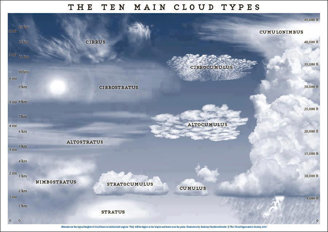
Here is the basic identification chart.
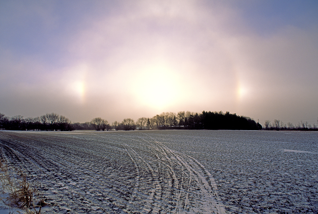
This was a very cold day (well below zero) and thus the fog was comprised of ice crystals just like in cirrostratus clouds. This produced the same features you can see in cirrostratus clouds at high altitude: a halo with parahelia (sundogs) on either side.
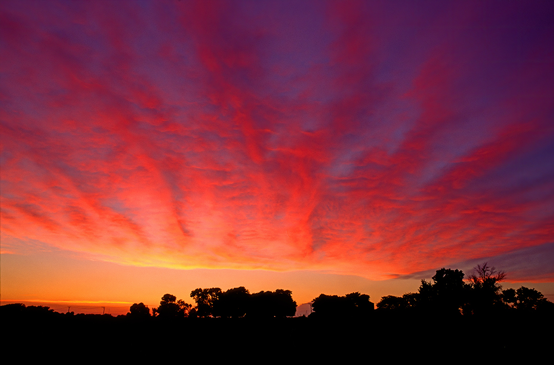
These are altocumulus billow clouds formed at medium altitude due to high velocity winds.
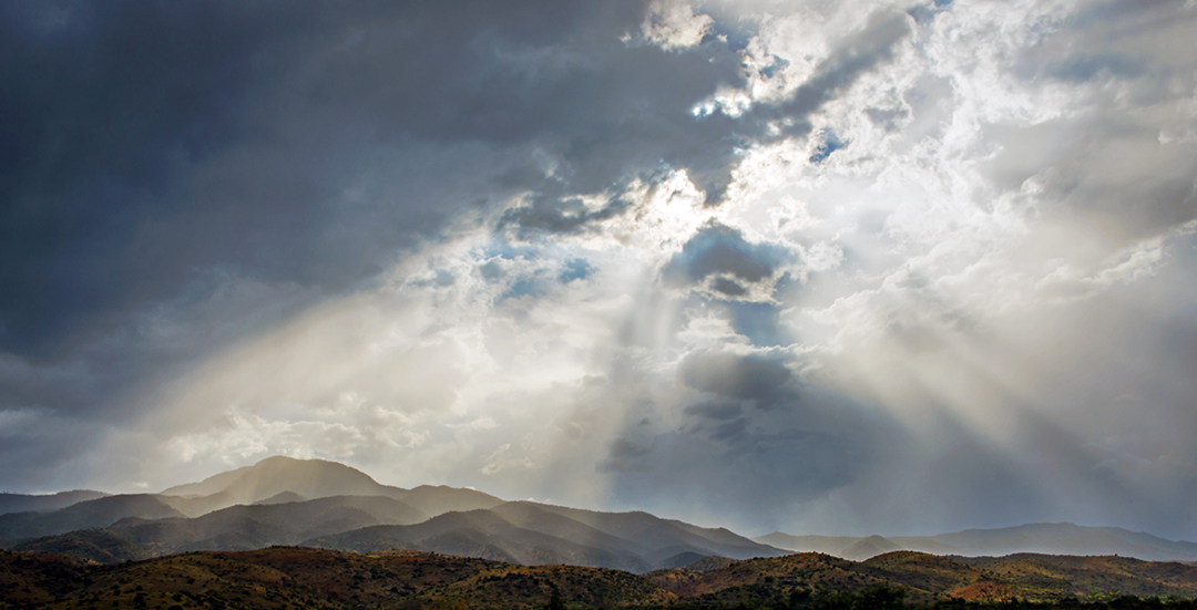
Crepuscular rays resulting from the sun passing through openings in the clouds. These are commonly called sunbeams.
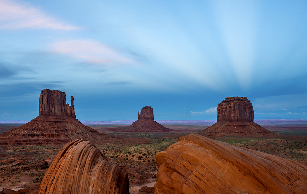
Anticrepuscular rays. These form at twilight when the sunset is behind you. They are actually parallel, but the perspective makes them appear to be converging.
Here is the basic identification chart.
This was a very cold day (well below zero) and thus the fog was comprised of ice crystals just like in cirrostratus clouds. This produced the same features you can see in cirrostratus clouds at high altitude: a halo with parahelia (sundogs) on either side.
These are altocumulus billow clouds formed at medium altitude due to high velocity winds.
Crepuscular rays resulting from the sun passing through openings in the clouds. These are commonly called sunbeams.
Anticrepuscular rays. These form at twilight when the sunset is behind you. They are actually parallel, but the perspective makes them appear to be converging.
Last edited:
")