AlanLichty
Moderator
This post may be closer to something that qualifies as Journalistic and Documentary but I will stick it here as a Historical thread for starters.
I started to present this thread a while back but as I was looking around the internet for updated information I stumbled across a number of articles describing excavations that have taken place at this location since around 2000. What they have found changes our understanding of how the tomb facades were used and constructed in some fairly significant ways. The initial french language articles I found were in the journal Syria Archeologie, Art et Histoire published in 2008:
https://journals.openedition.org/syria/445
And later I also found another set of articles in AUAC - The Association for the Understanding of Ancient Cultures that were in english. All of the images in these publications are copyrighted material so I can't simply insert the ones that overlap my own but I will put in links as I go along here.
Wadi Farasa is the first major drainage right after you enter Petra from the east side along the trail through the Siq. I have shown one tomb that is right near the entrance to Wadi Farasa (Renaissance Tomb) that is independent from the rest of what is at this location. I was going to have a set of different threads on the various highlights within the drainage but as it turns out this is actually a very large complex of related structures.
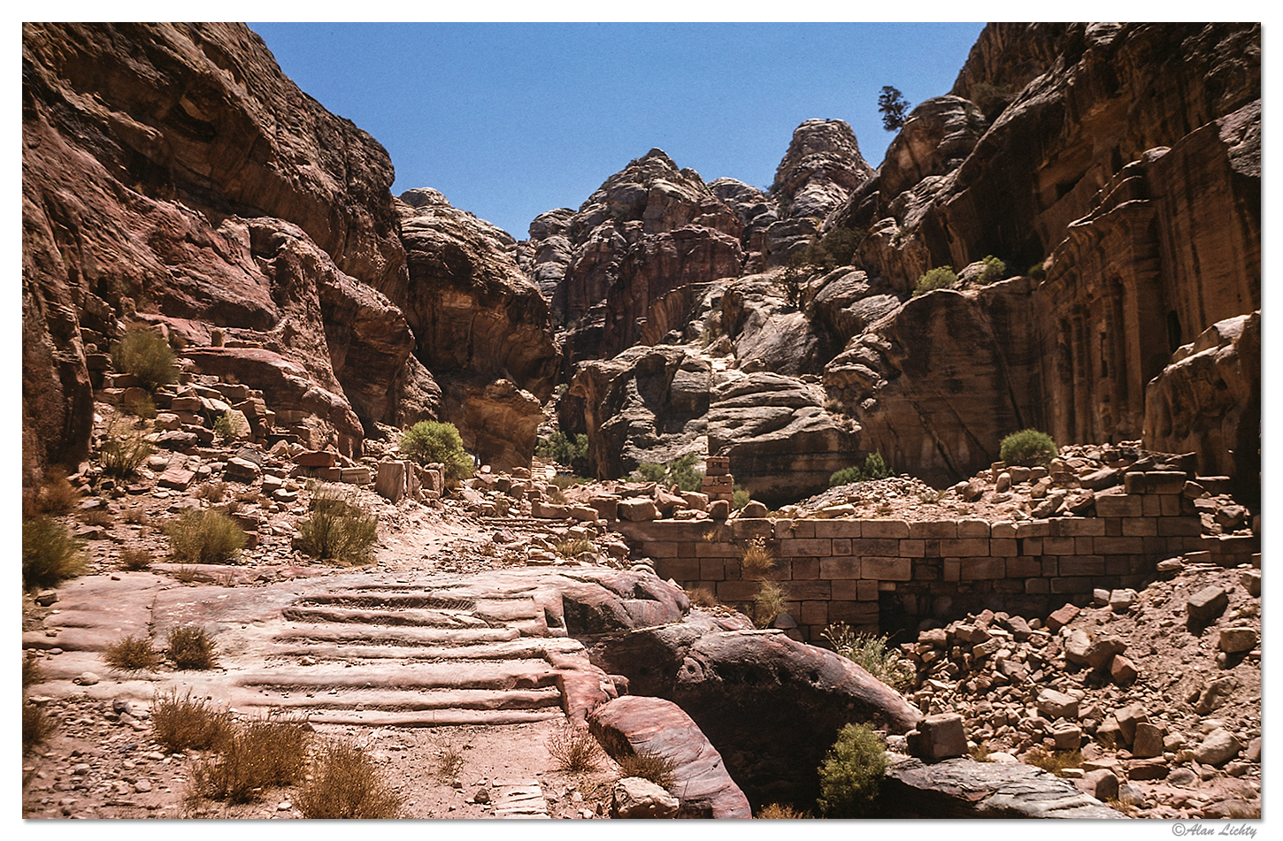
The view looking up Wadi Farasa - along the right hand side of the cliff walls is a facade known as The Soldier Tomb. In the background you can see more stairs leading to a secondary complex.
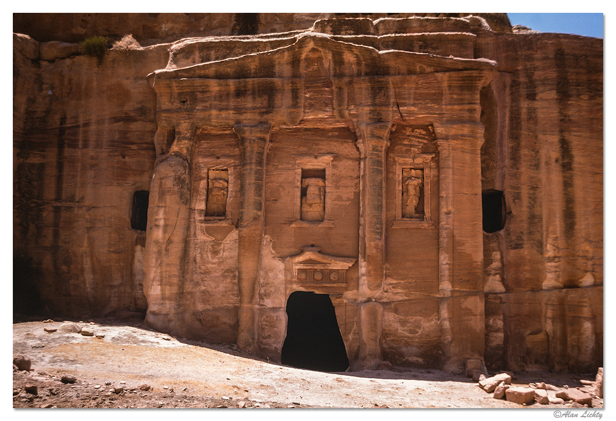
The Soldier Tomb as it existed in 1977.
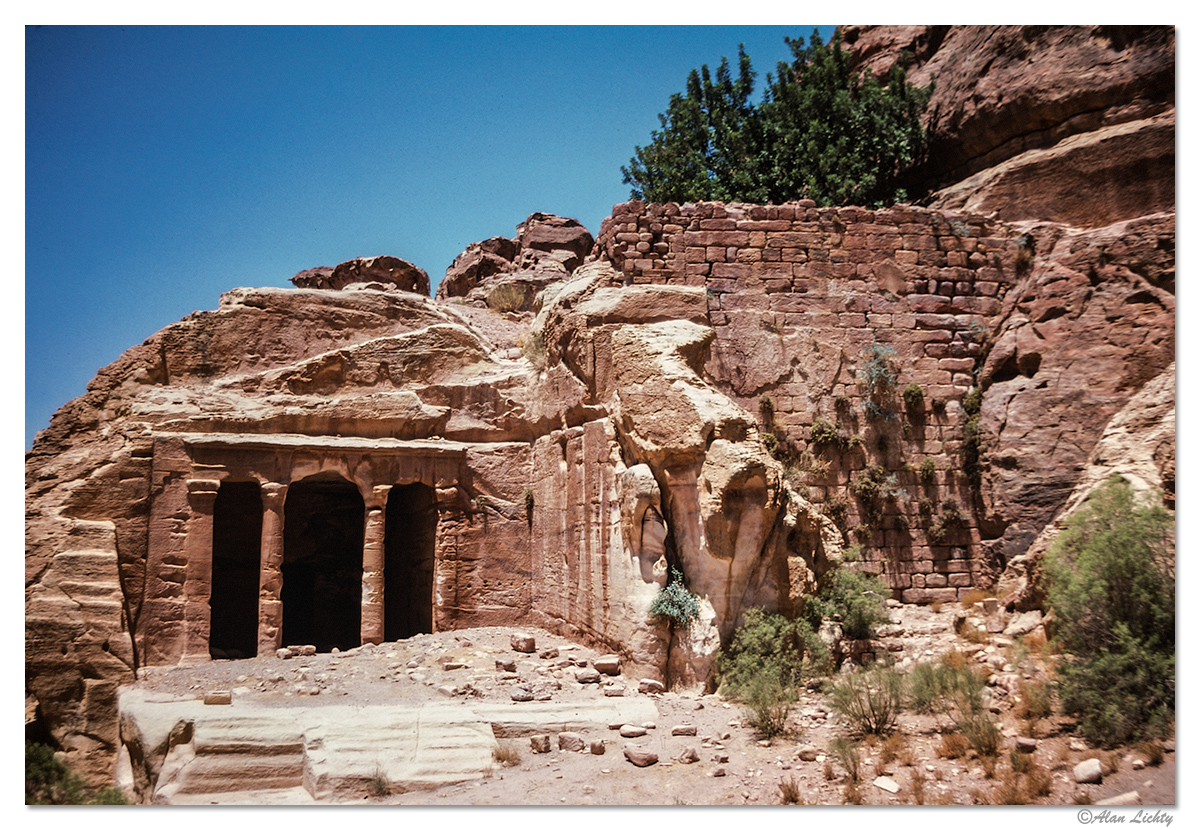
Farther up the wadi is another facade known by its descriptive name The Triclinium. Note that next to it is a small dam which always fascinated me for the vertical garden growing on the face.
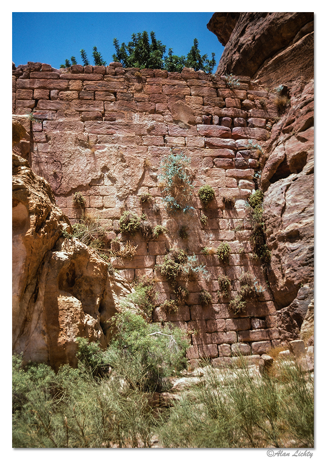
A more detailed image of the vertical garden on the dam face:
Climbing above the dam gives a view into how those plants were thriving (along with the carob tree)
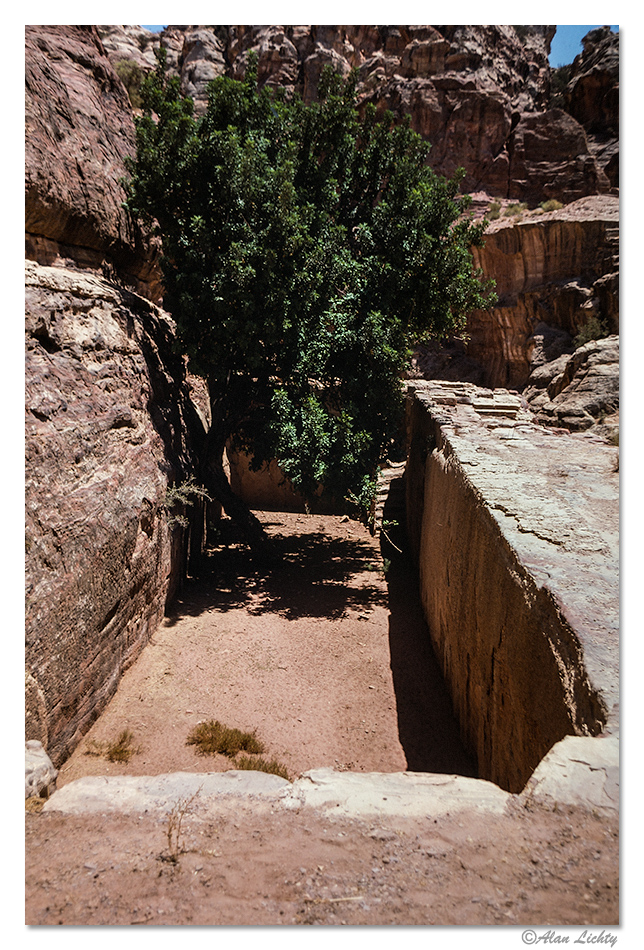
There was a very extensive set of water channels carved into the entire mountainside above this spot to capture any rain that fell and direct it into the small reservoir behind the dam. The reservoir has silted in from both wind blown sand as well as what has eroded from the mountainside behind the structure but the water channels still funnel runoff into the structure and the soil was sustaining the plants.
Emphasis on how things used to look is the key to what Wadi Farasa looks like today. In 2001 a collection of researchers initiated the International Wadi al-Farasa Project (IWFP) with excavations continuing through 2010. The silted in reservoir has now been excavated so the water source for the vertical garden is now gone.
The first image I posted above shows the approach to the area of the Soldier Tomb. The following link shows what this area looks like after the 2004 excavation season:
https://www.auac.ch/projects/iwfp/season2004/iwfp_2004_text06.html
The complex of structures at the Soldier Tomb stretched across the entire wadi entrance and included a large banquet area with a colonnaded courtyard just outside of the buildings.
The following link shows some reconstructions of what this set of structures might have looked like:
https://www.auac.ch/iwfp/season2006/iwfp_2006_text04.html
The Triclinium and the wall dam were actually part of this same complex and provided water for the features in the complex below. Excess water was channeled into a water system that routed across the hillside above the city to the south and drained into storage chambers carved into Umm al-Biyara. This is a link to what the Triclinium looks like after excavations:
https://journals.openedition.org/syria/docannexe/image/445/img-3-small480.png
For anyone who is interested in checking out the full set of IWFP articles I include the following link:
https://www.auac.ch/iwfp/
Thanks for following along.
C&C always welcome.
I started to present this thread a while back but as I was looking around the internet for updated information I stumbled across a number of articles describing excavations that have taken place at this location since around 2000. What they have found changes our understanding of how the tomb facades were used and constructed in some fairly significant ways. The initial french language articles I found were in the journal Syria Archeologie, Art et Histoire published in 2008:
https://journals.openedition.org/syria/445
And later I also found another set of articles in AUAC - The Association for the Understanding of Ancient Cultures that were in english. All of the images in these publications are copyrighted material so I can't simply insert the ones that overlap my own but I will put in links as I go along here.
Wadi Farasa is the first major drainage right after you enter Petra from the east side along the trail through the Siq. I have shown one tomb that is right near the entrance to Wadi Farasa (Renaissance Tomb) that is independent from the rest of what is at this location. I was going to have a set of different threads on the various highlights within the drainage but as it turns out this is actually a very large complex of related structures.
The view looking up Wadi Farasa - along the right hand side of the cliff walls is a facade known as The Soldier Tomb. In the background you can see more stairs leading to a secondary complex.
The Soldier Tomb as it existed in 1977.
Farther up the wadi is another facade known by its descriptive name The Triclinium. Note that next to it is a small dam which always fascinated me for the vertical garden growing on the face.
A more detailed image of the vertical garden on the dam face:
Climbing above the dam gives a view into how those plants were thriving (along with the carob tree)
There was a very extensive set of water channels carved into the entire mountainside above this spot to capture any rain that fell and direct it into the small reservoir behind the dam. The reservoir has silted in from both wind blown sand as well as what has eroded from the mountainside behind the structure but the water channels still funnel runoff into the structure and the soil was sustaining the plants.
Emphasis on how things used to look is the key to what Wadi Farasa looks like today. In 2001 a collection of researchers initiated the International Wadi al-Farasa Project (IWFP) with excavations continuing through 2010. The silted in reservoir has now been excavated so the water source for the vertical garden is now gone.
The first image I posted above shows the approach to the area of the Soldier Tomb. The following link shows what this area looks like after the 2004 excavation season:
https://www.auac.ch/projects/iwfp/season2004/iwfp_2004_text06.html
The complex of structures at the Soldier Tomb stretched across the entire wadi entrance and included a large banquet area with a colonnaded courtyard just outside of the buildings.
The following link shows some reconstructions of what this set of structures might have looked like:
https://www.auac.ch/iwfp/season2006/iwfp_2006_text04.html
The Triclinium and the wall dam were actually part of this same complex and provided water for the features in the complex below. Excess water was channeled into a water system that routed across the hillside above the city to the south and drained into storage chambers carved into Umm al-Biyara. This is a link to what the Triclinium looks like after excavations:
https://journals.openedition.org/syria/docannexe/image/445/img-3-small480.png
For anyone who is interested in checking out the full set of IWFP articles I include the following link:
https://www.auac.ch/iwfp/
Thanks for following along.
C&C always welcome.